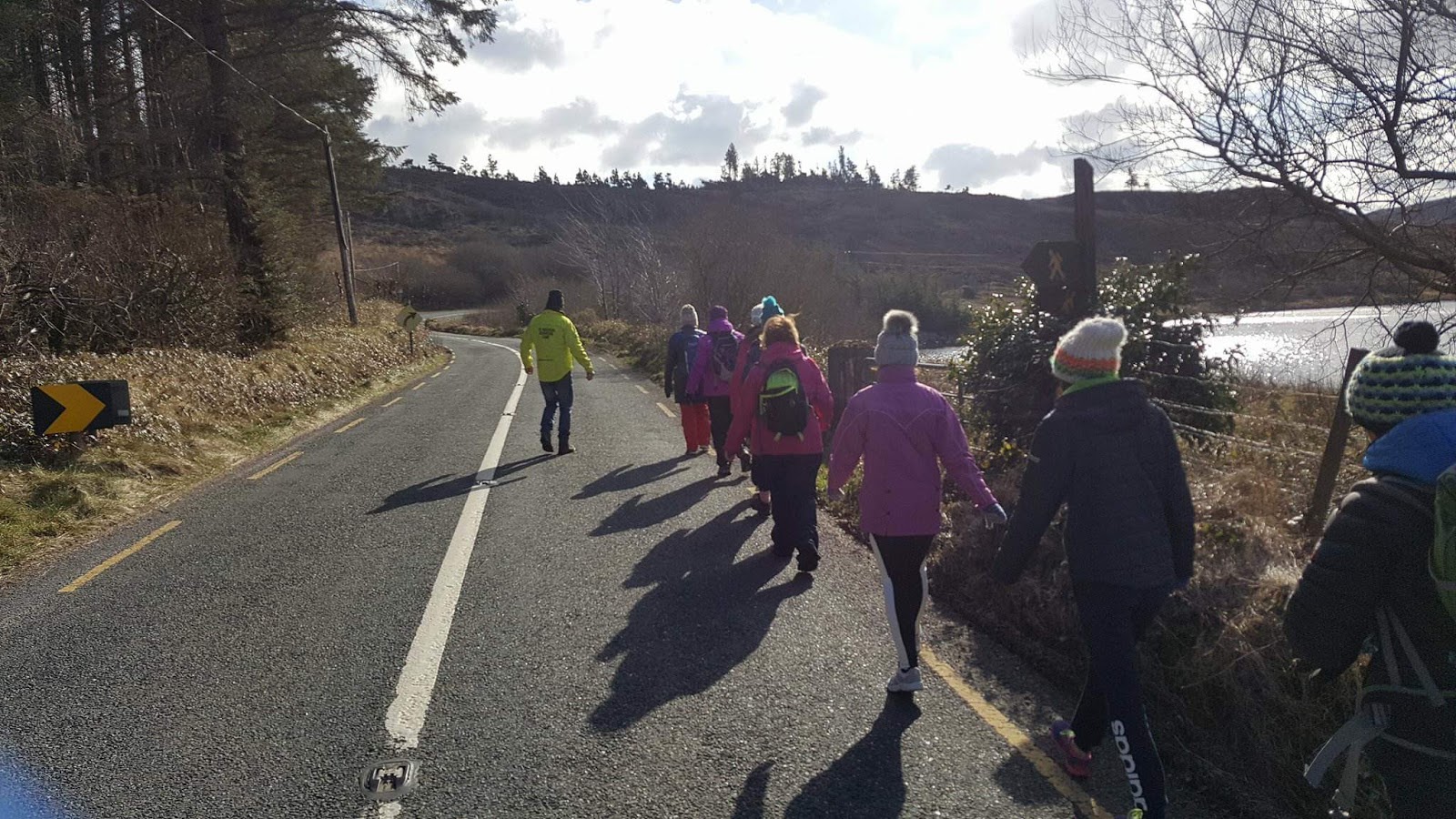
LOUGH TALT: destination for walkers, nature lovers, anglers and history-minded people
We had a wonderful day at logging Talt, following invitation to
participate on the walking trail Lough Talt - Gorterslin with Sligo walkers
from Sligo walking club, Mountaineering club and Ox mountain adventure
camp.

It was a lovely scenic walk around the shores of picturesque lake which
is home to a diverse range of bird life, with wild ducks, swans and dippers to
be seen overhead. Lough Talt is a nice blue lake of about 200 acres
situated at the foothills of the Ox Mountains in South Sligo between the
villages of Tubbercurry, Aclare and Bunnyconnellan, in
the West of Ireland. It is the largest of the lakes in the Lough Hoe Bog area.
It is a glacier lake and lies at approximately 500 ft above sea level and
measures 67 ft at its deepest point.
 |
| Nature lovers and walkers are drawn to Ox Mountain with Lough Easkey, Lough Talt and the surrounding hillside |
The lake is perfect for different kind of activities including fishing
and stand up paddle boarding.The lake boasts an abundance of brown trout,
making it a popular destination with anglers. In turn, the Lough Talt
mountain pass is popular among walkers. Nature lovers and walkers are drawn to
this area with Lough Easkey, Lough Talt and the surrounding hillside believed
to be one of the two most important sites of blanket bog left in the world.
Close by is Knocknashee, the legendary hill of the fairies, with a superb
plateau and fabulous views.
 |
| Walk around Lough Talt can be fantastic family outing. Local sheeps were so friendly! |
But also this place can be interesting for history-minded people.
Raising up in Gorterslin (Aclare) we found grave of fallen french soldier of
1798 - The Frenchman's Grave. This place keeps pages of history filled of blood, great hopes and great
dissapointments.
 |
| Although the reputed burial place of the soldier has been known locally for generations as The Frenchman's Grave, it's also thought hundreds of General Humbert's soldiers may have died on the mountain side |
A french soldier who took ill and died more than 200 years ago on the windswept slopes
of the Ox Mountains while marching with General Humbert's army from Ballina to
Tubbercurry has been commemorated with the erection of a plaque on what is
believed to be his final resting place.
The
soldier was a member of the 1,100 strong French force that had landed at
Killala in support of the Irish during the 1798 Rebellion. Since then, the
story of the fallen soldier has been handed down through the generations in South
Sligo, with his grave generally believed to be at Gorterslin.
During the year, General Jean Joseph Amable Humbert marched his army through
the Lough Talt valley on the way from Bonniconlon to battle in Longford. At
least three French soldiers perished and are buried at the Old Gorterslin road
overlooking Lough Talt (French Mans Grave) and on the Bonniconlon side of the
gap in an area known as the French Man’s bridge.

How to get to the Trailhead for Lough Talt Loop Walk:
First take the N4 in the direction of Dublin. At
Coolooney take the N17 in the direction of Galway upon reaching Tubbercurry
(approx.35km from Sligo) at a T-junction take a right onto the R294 signposted
Ballina. This road will bring you into the Ox Mountains. After 13km you come
over the brow of the hill and Lough Talt is visible, take a left turn onto a
narrow road. Car parking is available along the lake shore.
The first section of this walk is along a lakeshore
track with the return journey along a busy road. For this reason families with
young children may prefer to make their return back along the same track.
Follow the track along the western shore of the lake. Head uphill from the
lake, past the ruins of some houses, through the gates and onto an old road.
Take a right turn onto the R294 near the gap and follow the main road back
along the eastern side of the lakeshore.


Комментарии
Отправить комментарий